Ellis Friedrich · 16 October 2026
Charting Inlet Hydrology Shifts and Their Ripple Effects on Historic Port Accessibility in Regional Trade Networks
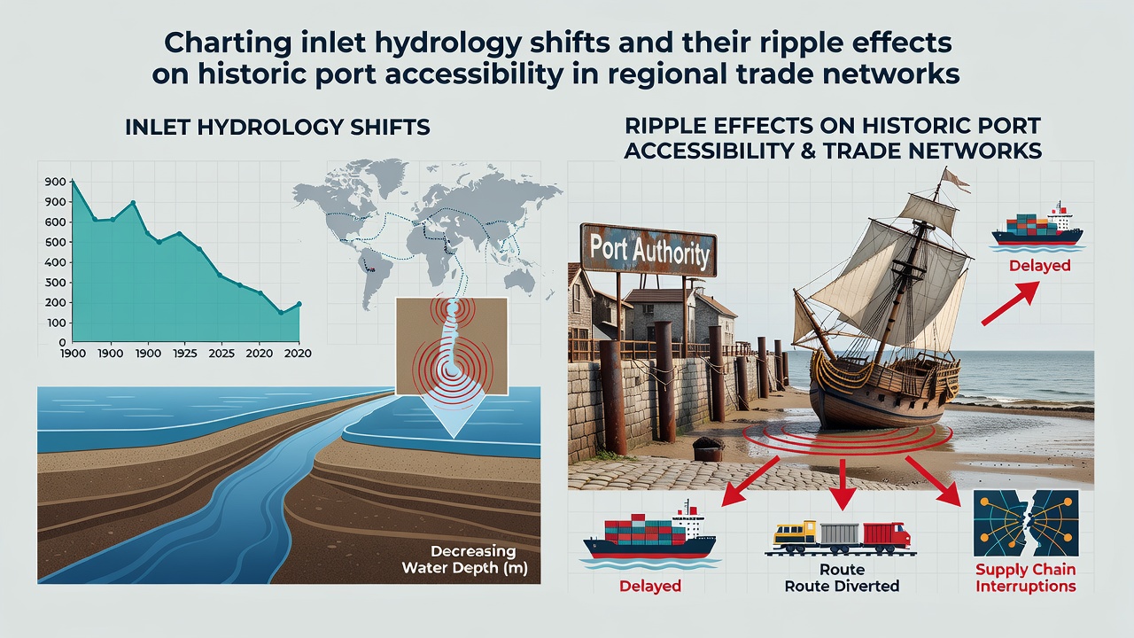
Coastal inlets function as dynamic gateways where freshwater meets marine environments, and researchers track changes in water depth, sediment load, and current velocity that alter these passages over time. Data from long-term monitoring stations show that hydrology shifts often stem from a combination of sea level rise, altered precipitation patterns, and human interventions such as dredging or upstream dam construction. These modifications reshape navigation channels, forcing port authorities to adjust operational schedules and vessel draft restrictions accordingly.
Observed Hydrology Changes Across Multiple Regions
Measurements collected by the National Oceanic and Atmospheric Administration along the eastern seaboard of the United States reveal gradual deepening in some inlet throats alongside rapid shoaling in others, with annual sediment deposition rates varying between 0.3 and 1.2 meters in documented cases. Similar patterns appear in records maintained by Transport Canada for Atlantic ports, where tidal amplification combined with increased storm frequency has widened certain entrances while narrowing adjacent approaches. In October 2026, updated bathymetric surveys from these agencies will provide fresh baselines for comparison against earlier datasets spanning the previous three decades.
European monitoring networks coordinated through the European Environment Agency document comparable inlet adjustments in the Baltic and North Seas, where reduced river discharge during dry periods leads to greater saltwater intrusion and subsequent changes in benthic sediment composition. These shifts influence not only channel stability but also the structural integrity of historic wharves built when water levels and flow regimes differed markedly from present conditions.
Effects on Historic Port Infrastructure
Many legacy ports developed around inlet configurations that no longer match current hydrology, resulting in restricted access for deeper-draft vessels that now dominate regional trade fleets. Engineers examining wooden pilings and stone breakwaters at sites in New England note accelerated erosion when altered current patterns direct stronger flows against foundations previously shielded by sediment bars. Port operators respond by implementing real-time depth sensors and revised pilotage protocols to maintain safe passage despite these evolving conditions.
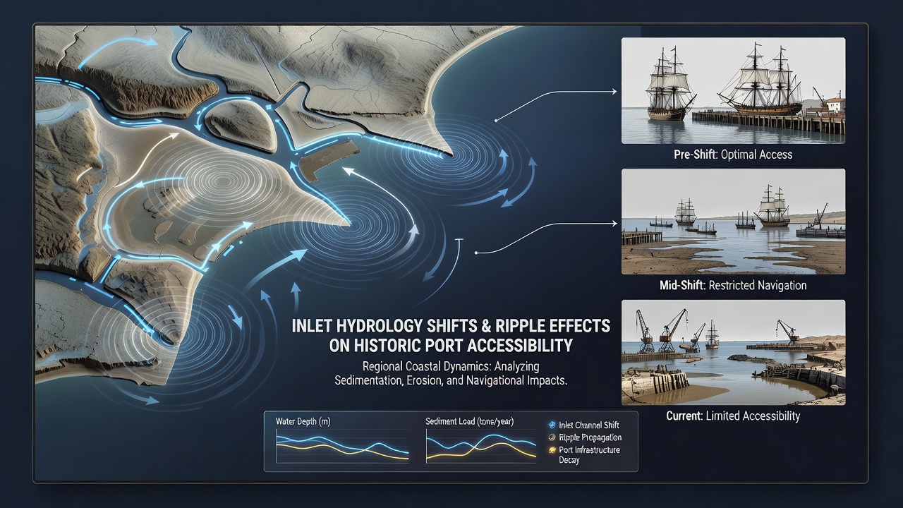
Researchers studying Mediterranean inlets have identified cases where reduced freshwater outflow concentrates saline water near port basins, increasing corrosion rates on metal components installed during earlier centuries. Maintenance crews therefore schedule more frequent inspections, and port authorities allocate additional resources toward sediment management programs that attempt to restore navigable depths without disrupting established trade routes.
Consequences for Regional Trade Networks
When inlet accessibility declines, shipping companies reroute cargo through alternative facilities, which raises transportation costs and extends delivery timelines for goods moving between coastal hubs. Trade statistics compiled by the Australian Bureau of Meteorology in collaboration with maritime authorities indicate that seasonal inlet closures at certain southern ports have prompted carriers to consolidate loads at larger terminals, concentrating economic activity while smaller historic sites experience reduced throughput. Supply chain analysts observe that these adjustments ripple outward, affecting warehousing demands and inventory strategies across connected inland networks.
Studies from university research groups in Canada and Scandinavia further show that prolonged restrictions on inlet access correlate with shifts in commodity types handled at affected ports, as bulk carriers carrying lower-value goods seek deeper-water alternatives while specialized vessels continue limited operations. Local economies tied to these historic ports adapt through infrastructure upgrades or diversification into non-maritime sectors, although the pace of change varies depending on available funding and regulatory frameworks.
Monitoring Techniques and Data Integration
Modern charting relies on multibeam sonar arrays, satellite-derived bathymetry, and autonomous underwater vehicles that collect high-resolution profiles of inlet floors at regular intervals. Analysts integrate these readings with hydrodynamic models that simulate future scenarios under different climate projections, allowing planners to anticipate periods when channel maintenance becomes necessary. Government agencies share processed datasets through open portals, enabling port managers and academic teams to cross-reference findings from multiple geographic areas.
One research initiative in the Pacific Northwest combined acoustic Doppler current profiler data with historical navigation logs to reconstruct inlet evolution since the late nineteenth century, revealing that certain channels have migrated laterally by several hundred meters over the past century. Such reconstructions help explain why some older port facilities now sit offset from primary shipping lanes and require supplementary dredging campaigns to remain viable.
Conclusion
Continued observation of inlet hydrology provides essential information for preserving the functionality of historic ports within broader trade systems. As datasets expand through collaborative efforts across regions, stakeholders gain clearer pictures of how sediment dynamics and water level changes interact with infrastructure designed under previous environmental conditions. These insights support targeted interventions that sustain accessibility while accounting for the interconnected nature of regional commerce.